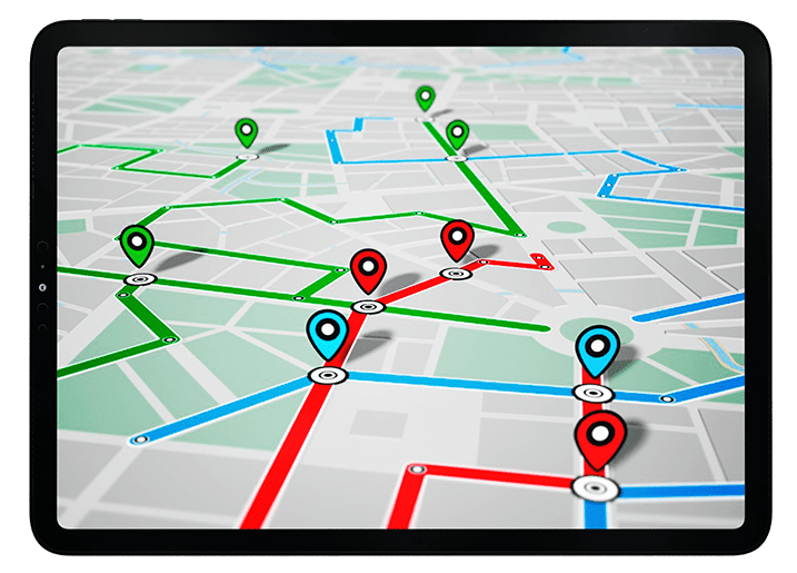

GPS tracking has become an important part of modern technology.
From cars and delivery trucks to smartphones, fitness watches, drones and industrial equipment, GPS tracking allows people and businesses to understand where an asset or device is located.
The technology may look simple from the outside.
A person opens an application, sees a vehicle on a map and assumes the GPS tracker simply sends its location to the app.
In reality, a modern GPS tracking system involves several technologies working together.
A tracker needs to determine its position using satellite signals. It then needs a communication method to send that location to a server. The server processes the information, stores it and presents it to the user through an application or web dashboard.
Depending on the system, GPS tracking can also include sensors for speed, acceleration, movement, temperature, battery status and other information.
This makes modern GPS trackers much more than simple location devices.
They have become complete monitoring platforms for vehicles, people, equipment and connected assets.
As businesses increasingly depend on logistics, transportation and automation, GPS tracking technology is expected to become even more important.
What Is a GPS Tracking Device?
A GPS tracking device is an electronic device that uses satellite positioning technology to determine its location.
The device typically contains a GNSS receiver.
GPS is one satellite navigation system, while GNSS is the broader term for satellite navigation systems.
Depending on the hardware, a tracker may receive signals from multiple satellite constellations.
Once the device calculates its position, it can transmit the information to another system.
That communication may use:
- Cellular networks
- Wi-Fi
- Bluetooth
- Satellite communication
- Specialized radio networks
The exact communication technology depends on the tracker.
How Does a GPS Tracker Work?
A typical GPS tracking system follows a simple process.
Step 1: Satellites Transmit Signals
Navigation satellites continuously broadcast signals containing timing and orbital information.
Step 2: The Tracker Receives the Signals
The GPS tracker uses an antenna and GNSS receiver to detect signals from multiple satellites.
Step 3: The Tracker Calculates Its Position
The receiver calculates its latitude, longitude and usually altitude.
Step 4: The Device Collects Additional Information
Depending on the tracker, it may also collect:
- Speed
- Direction
- Movement
- Battery level
- Engine status
- Temperature
Step 5: Data Is Transmitted
The tracker sends the information to a remote server.
Step 6: The Server Processes the Data
The server can store the information and calculate routes, stops, alerts and other events.
Step 7: The User Views the Location
A mobile application or web dashboard displays the vehicle or asset on a map.
This process can happen repeatedly throughout the day.
GPS Tracking Is Not the Same as GPS Navigation
GPS tracking and GPS navigation are related but have different purposes.
GPS Navigation
Navigation helps a user determine where they are and how to reach a destination.
For example, a driver uses a navigation application to find a route.
GPS Tracking
Tracking focuses on monitoring the location of an object over time.
For example, a logistics company can monitor the locations of its delivery vehicles.
Navigation answers:
Where am I going?
Tracking answers:
Where is the device now, and where has it been?
Main Components of a GPS Tracking Device
A modern tracker can contain several important components.
GNSS Receiver
The receiver detects satellite navigation signals.
Antenna
The antenna receives the radio signals transmitted by satellites.
Processor
The processor calculates position and processes sensor information.
Communication Module
The communication system sends location data to a server.
Battery
Portable trackers require a power source.
Sensors
Some trackers contain accelerometers, gyroscopes or other sensors.
Storage
Certain devices can store location information when communication is temporarily unavailable.
What Is a Real-Time GPS Tracker?
A real-time GPS tracker sends location information at regular intervals.
For example, a tracker could update its location every few seconds or minutes.
The user can then see the latest available position on a map.
The term "real-time" does not necessarily mean the location changes continuously every millisecond.
Instead, it generally means the system is capable of providing frequent location updates with relatively little delay.
How Accurate Are GPS Tracking Devices?
GPS tracking accuracy depends on several factors.
Under good outdoor conditions, modern GNSS receivers can provide very useful location accuracy.
However, accuracy can decrease because of:
- Tall buildings
- Trees
- Mountains
- Poor satellite visibility
- Signal reflections
- Atmospheric effects
- Antenna quality
- Receiver quality
A tracker inside a vehicle parked between tall buildings may perform differently from the same tracker operating in an open field.
Why GPS Trackers Sometimes Show the Wrong Location
A GPS tracker does not always know its position perfectly.
Several factors can produce errors.
Weak Satellite Signals
Buildings or other obstacles can reduce signal quality.
Multipath
Signals can reflect from surfaces before reaching the receiver.
Poor Antenna Placement
An antenna surrounded by metal or other obstacles may have reduced reception.
Limited Satellite Visibility
The receiver needs enough useful satellite signals to calculate a reliable position.
Communication Delay
The tracker may know its location correctly but send the information to the server later.
This can make the displayed position appear outdated.
GPS Location vs Last Known Location
This is an important concept in GPS tracking.
If a tracker loses communication with the server, the application may continue showing the last location received.
That location may not represent the device's current position.
For example, a vehicle could enter an area without cellular service.
The tracker might continue calculating its location internally but be unable to upload the data.
When connectivity returns, the tracker may send stored information to the server.
GPS Tracker With Cellular Connectivity
Many vehicle trackers use cellular networks to transmit data.
The process can be:
GPS satellites → Tracker → Cellular network → Server → Mobile app
This allows a user to monitor the vehicle remotely.
The tracker itself determines its location.
The cellular network simply provides the communication path.
What Happens When Cellular Service Is Lost?
A good tracker can sometimes store location data locally.
When communication returns, it can upload the stored information.
This feature is often useful for fleet-management systems.
However, the exact behavior depends on the device.
Some basic trackers may simply stop updating until connectivity returns.
Types of GPS Tracking Devices
GPS trackers are available in many different forms.
Vehicle GPS Trackers
Designed for cars, trucks, vans and other vehicles.
Fleet GPS Trackers
Used by businesses managing multiple vehicles.
Personal GPS Trackers
Designed for people, pets or personal belongings.
Asset GPS Trackers
Used for equipment, machinery and valuable assets.
Portable GPS Trackers
Battery-powered devices that can be moved between locations.
Hardwired GPS Trackers
Connected directly to a vehicle's electrical system.
GPS Wearables
Devices such as watches can include GNSS tracking.
Satellite GPS Trackers
Used in areas where cellular networks are unavailable.
Vehicle GPS Trackers
Vehicle tracking is one of the most popular GPS tracking applications.
A vehicle tracker can provide:
- Current location
- Speed
- Direction
- Route history
- Stops
- Movement alerts
- Geofence alerts
Advanced systems may provide additional vehicle information.
How Vehicle GPS Tracking Helps Businesses
Businesses with multiple vehicles can use GPS tracking to improve operational visibility.
For example, a logistics company may have dozens or hundreds of vehicles on the road.
Without tracking, managers may have limited information about their locations.
With GPS tracking, the company can monitor the fleet through a central dashboard.
Fleet GPS Tracking
Fleet tracking systems are designed specifically for organizations managing multiple vehicles.
A fleet platform can display vehicles on a single map.
Managers can potentially view:
- Vehicle location
- Driver routes
- Stops
- Trip history
- Estimated arrival times
- Vehicle status
This can improve logistics planning.
GPS Tracking for Delivery Companies
Delivery businesses depend heavily on timing.
A company may need to know:
- Where a delivery vehicle is
- Whether it is moving
- How long it has stopped
- Which route it is taking
- When it might arrive
GPS tracking can provide this information.
GPS Tracking and Route Optimization
Tracking data can be analyzed to identify inefficient routes.
For example, a business may discover that vehicles repeatedly travel through congested roads.
Managers can use this information to improve future routes.
Modern systems can combine GPS data with traffic information to provide better route planning.
GPS Tracking and Fuel Efficiency
GPS data can also help businesses understand vehicle usage.
Excessive:
- Idling
- Speed changes
- Detours
- Unnecessary trips
can increase fuel consumption.
Tracking systems can help identify these patterns.
GPS Tracking for Logistics
Logistics companies transport goods over long distances.
GPS tracking can help provide visibility throughout the journey.
A company may be able to monitor:
Departure → Transit → Stops → Destination
This improves shipment visibility.
GPS Asset Tracking
Not every tracker needs to be installed in a vehicle.
Companies can attach GPS trackers to:
- Construction equipment
- Generators
- Trailers
- Containers
- Agricultural machinery
- Industrial equipment
This is known as asset tracking.
GPS Tracking for Construction Equipment
Construction machinery can be expensive.
Companies may use GPS trackers to monitor equipment locations.
Tracking can help answer questions such as:
- Where is the equipment?
- Is it being moved?
- How long has it been at a site?
- Is it being used?
This can improve asset management.
GPS Tracking for Agriculture
Modern agricultural machinery can use satellite positioning for precision farming.
GPS tracking can help monitor:
- Tractors
- Harvesters
- Sprayers
- Field operations
- Equipment movement
The same positioning technology can also support precision agriculture applications.
GPS Tracking for Personal Devices
Small GPS trackers can be used for personal applications.
Depending on local laws and the device, examples can include:
- Personal location sharing
- Asset recovery
- Pet tracking
- Outdoor activities
Responsible use is important, especially when tracking people.
Location tracking should respect privacy, consent and applicable laws.
GPS Pet Trackers
Pet tracking devices can help owners locate animals.
A typical pet tracker may combine:
- GNSS
- Cellular connectivity
- Battery
- Mobile application
The owner can view the pet's approximate location through the app.
GPS Tracking and Geofencing
Geofencing is one of the most useful features of GPS tracking.
A geofence is a virtual boundary created around a geographic area.
For example, a business can create a geofence around:
- Warehouse
- Office
- Construction site
- Customer location
When a tracker enters or leaves the area, the system can generate an alert.
How Geofencing Works
The tracking server continuously compares the device's location with the defined geographic boundary.
If the location crosses the boundary, the software recognizes an event.
The system can then send:
- Push notification
- SMS
- Dashboard alert
The exact options depend on the platform.
GPS Tracking and Route History
Tracking systems can store historical locations.
This allows users to review previous journeys.
A route-history report may show:
- Starting location
- Destination
- Stops
- Route
- Travel time
- Distance
This can be useful for business analysis.
GPS Tracking and Driver Behavior
Some fleet-management systems can use GPS and vehicle sensors to identify driving patterns.
Depending on the hardware, the system may detect:
- Excessive speed
- Hard acceleration
- Sudden braking
- Excessive idling
- Unusual route changes
This information can be used to improve driver safety and operational efficiency.
GPS Tracking and Vehicle Telematics
GPS is an important component of vehicle telematics.
Telematics combines communication, vehicle information and location technology.
A modern telematics system can potentially collect:
- Location
- Speed
- Vehicle diagnostics
- Fuel information
- Engine data
- Driver behavior
GPS provides the geographic component.
GPS Tracking in Emergency Services
Emergency services can use location technology to understand where vehicles or personnel are operating.
Location information can help coordinate resources.
For example, a control center may need to know which emergency vehicle is closest to an incident.
GPS tracking can support this type of coordination.
GPS Tracking in Public Transportation
Buses and other public transportation vehicles can use GPS tracking.
Passengers may then receive information about:
- Vehicle location
- Estimated arrival
- Route progress
Transit agencies can also analyze vehicle movement to improve operations.
GPS Tracking and Ride-Sharing
Ride-sharing applications depend heavily on location technology.
The platform needs to know where:
- Drivers are
- Passengers are
- Vehicles are moving
GPS and other location technologies make this possible.
GPS Tracking in Aviation
Aircraft can use satellite navigation for positioning and navigation.
Tracking systems can also provide location information to operators.
Aviation systems use multiple navigation technologies because safety-critical operations should not rely on a single source.
GPS Tracking in Maritime Operations
Ships can use GPS-based positioning to monitor their location.
Fleet operators can track vessels across large geographic areas.
In remote environments, satellite communication may be required to transmit tracking data.
Satellite-Based GPS Tracking
Cellular networks do not cover every part of the planet.
Ships, aircraft and remote industrial operations can travel through areas where cellular coverage is unavailable.
Satellite communication can provide an alternative.
A satellite tracker can transmit information through a satellite communication network.
This is generally more expensive than ordinary cellular tracking, but it can provide coverage in remote locations.
GPS Tracker Battery Life
Battery life varies widely.
Factors include:
- Battery capacity
- Update frequency
- Cellular signal strength
- GPS acquisition frequency
- Sensor activity
- Device size
- Temperature
A tracker that reports every few seconds may consume more power than one that reports every hour.
Why Update Frequency Matters
Suppose a tracker sends one location update every 60 seconds.
The displayed location may be up to approximately a minute old.
A tracker sending updates every few seconds can provide a more current picture.
However, higher update frequency can increase:
- Battery consumption
- Data usage
- Processing requirements
There is therefore a trade-off.
GPS Tracking in Sleep Mode
Battery-powered trackers often use low-power modes.
When the device is stationary, it may reduce activity.
When movement is detected, it can become active again.
This can significantly improve battery life.
Motion Sensors in GPS Trackers
Accelerometers can detect movement.
A tracker can use this information to determine whether an asset is moving or stationary.
This can help reduce unnecessary GPS activity.
For battery-powered devices, this can be especially useful.
GPS Tracking and IoT
GPS tracking is becoming increasingly connected to the Internet of Things.
An IoT tracking system can combine location with other sensor information.
For example, a shipping tracker could potentially report:
- Location
- Temperature
- Humidity
- Shock
- Movement
- Battery level
This creates much more useful information than location alone.
GPS Tracking for Cold-Chain Logistics
Certain products require controlled temperatures during transportation.
Examples include:
- Food
- Pharmaceuticals
- Biological materials
A sophisticated tracking device can combine GPS with temperature sensors.
The system can then show both:
Where is the shipment?
and
What conditions is the shipment experiencing?
GPS Tracking and Smart Cities
Smart cities use connected technologies to manage urban infrastructure.
GPS tracking can contribute to:
- Public transport
- Waste management
- Emergency response
- Traffic analysis
- Fleet management
Location data can help city planners understand how transportation systems are being used.
GPS Tracking and Autonomous Vehicles
Autonomous vehicles require accurate positioning.
However, GPS is only one part of the solution.
Self-driving systems can combine:
- GNSS
- Cameras
- LiDAR
- Radar
- Inertial sensors
- Digital maps
This approach is known as sensor fusion.
Why Sensor Fusion Matters
Every sensor has strengths and weaknesses.
GPS can provide global positioning but can be affected by signal problems.
Cameras can understand visual information but can be affected by darkness or weather.
LiDAR can provide detailed distance measurements but may have limitations in certain environmental conditions.
Combining multiple sensors can create a stronger navigation system.
GPS Tracking and AI
Artificial intelligence is increasingly being applied to location data.
AI can analyze large volumes of tracking information.
It can identify patterns such as:
- Unusual routes
- Abnormal stops
- Repeated delays
- Unexpected movement
- Potential equipment problems
This moves GPS tracking from simple monitoring toward predictive analytics.
Predictive Fleet Management
Future fleet systems could potentially use historical GPS data to predict problems.
For example, software could identify patterns associated with:
- Delayed deliveries
- Traffic congestion
- Vehicle downtime
- Excessive fuel use
Managers could then take action before a problem becomes serious.
GPS Tracking and Cloud Computing
Modern tracking platforms usually rely heavily on cloud infrastructure.
The tracker sends data to a server.
The server processes and stores it.
Users access the information through:
- Web dashboards
- Mobile applications
- APIs
Cloud computing makes it possible to manage large numbers of devices from a central platform.
GPS Tracking APIs
Businesses can integrate GPS tracking information into their own software.
An API can allow another application to access:
- Device location
- Historical routes
- Vehicle status
- Geofence events
This is useful for logistics platforms, enterprise software and custom fleet applications.
GPS Tracking Security
Location data is sensitive.
A tracking system should protect information from unauthorized access.
Security can involve:
- Authentication
- Encryption
- Access controls
- Secure communication
- Device management
- Data retention policies
The exact security architecture depends on the application.
GPS Tracking and Privacy
Location information can reveal highly detailed movement patterns.
That makes privacy an important consideration.
Organizations using GPS tracking should understand applicable laws and establish clear policies regarding:
- Consent
- Data collection
- Data storage
- Access
- Retention
- Sharing
Tracking technology should be used responsibly.
GPS Tracking Limitations
GPS tracking is powerful, but it has limitations.
A tracker may experience problems because of:
- Weak satellite signals
- Poor cellular coverage
- Battery failure
- Hardware damage
- Signal interference
- Indoor environments
- Network outages
A professional tracking system should therefore consider these possibilities.
GPS Tracking vs Bluetooth Tracking
Bluetooth trackers and GPS trackers are different.
GPS Tracker
Can determine global location using satellite positioning.
Bluetooth Tracker
Usually relies on nearby compatible devices or networks to help identify its location.
Bluetooth trackers are often designed for small personal items.
GPS trackers are more suitable when independent positioning and remote tracking are required.
GPS Tracking vs Wi-Fi Tracking
Wi-Fi positioning can be useful indoors.
GPS generally performs better outdoors with open sky visibility.
Modern devices can combine both.
This creates a hybrid positioning system.
GPS Tracking Without Internet
A GPS receiver can calculate its location without an internet connection.
However, remote tracking requires some way to transmit the information.
Without communication connectivity, the tracker may still know its location but cannot necessarily send that information to a remote user immediately.
Some devices can store the information until connectivity becomes available.
GPS Tracking Without Cellular Service
A standard cellular GPS tracker may not be able to transmit real-time data when cellular service is unavailable.
For remote environments, satellite communication trackers can provide another option.
This is why choosing a tracker requires understanding where it will be used.
How to Choose a GPS Tracking Device
Different applications require different features.
Consider:
1. Coverage
Will the tracker operate where cellular networks are available?
2. Battery
How long should it operate between charges?
3. Update Frequency
How often does the location need to be updated?
4. Accuracy
Does the application require ordinary GPS accuracy or high-precision positioning?
5. Connectivity
Cellular, satellite or another communication method?
6. Sensors
Are temperature, movement or vehicle data required?
7. Software
Does the tracker include a useful application or dashboard?
8. Security
How is location data protected?
The Future of GPS Tracking
GPS tracking is moving toward more intelligent systems.
Future trackers are likely to combine:
- Multi-GNSS
- AI
- IoT sensors
- 5G and newer networks
- Satellite communication
- Edge computing
- Cloud analytics
- Advanced battery technology
This will make tracking systems more capable.
Multi-GNSS Tracking
Future trackers can increasingly use multiple satellite constellations.
Instead of depending exclusively on GPS, a receiver may use several GNSS systems.
This can improve satellite availability and positioning performance.
5G and GPS Tracking
Faster cellular networks can improve communication between tracking devices and cloud platforms.
The biggest benefit is not necessarily that 5G makes GPS itself more accurate.
Instead, faster connectivity can support:
- Lower communication latency
- More frequent data transmission
- More connected sensors
- Richer fleet-management systems
Edge Computing in GPS Tracking
Edge computing means processing information closer to the device.
Instead of sending every raw measurement to the cloud, a tracker can perform some analysis locally.
For example, it could identify:
- Movement
- Geofence events
- Abnormal behavior
and only transmit important information.
This can reduce communication requirements.
Satellite Tracking Will Expand
As satellite communication becomes more accessible, tracking in remote environments could become easier.
This may benefit:
- Shipping
- Aviation
- Agriculture
- Mining
- Outdoor recreation
- Scientific research
The combination of GNSS positioning and satellite communication can provide global tracking capabilities.
GPS Tracking and Space Technology
Satellite positioning is also becoming relevant to space-based navigation.
Spacecraft cannot always depend on traditional GPS, particularly when traveling far from Earth.
Future systems may use:
- Optical navigation
- Star tracking
- Autonomous navigation
- Inter-spacecraft positioning
NASA has demonstrated research into GPS-independent navigation for spacecraft.
In August 2026, NASA reported a demonstration involving its Starling mission and the FALCON experiment, which used optical observations to support spacecraft navigation without relying entirely on GPS. (nasa.gov)
GPS Tracking Is Becoming Location Intelligence
Traditional GPS tracking simply answered:
Where is the device?
Modern systems can answer much more:
Where is it?
Where has it been?
How fast is it moving?
What route did it take?
How long did it stop?
Is the movement normal?
Will it arrive on time?
Is there a possible problem?
This transformation from tracking to location intelligence is one of the biggest trends in the industry.
Frequently Asked Questions
What is a GPS tracking device?
A GPS tracking device is hardware that uses satellite navigation signals to determine its location and, in many cases, transmits that information to a remote server.
How does a GPS tracker work?
The tracker receives signals from satellites, calculates its position and sends that location through a communication network to a server or application.
Does a GPS tracker need internet?
The GPS receiver itself does not require the internet to calculate a location. However, remote tracking usually requires cellular, Wi-Fi, satellite or another communication method.
Does GPS tracking work without cellular service?
A standard cellular tracker may not be able to transmit real-time information without cellular coverage. Some devices can store data, while satellite-based trackers can provide coverage in remote areas.
How accurate is a GPS tracker?
Accuracy varies depending on satellite visibility, receiver quality, antenna design, environment and other factors. Open outdoor environments generally provide better conditions.
What is real-time GPS tracking?
Real-time GPS tracking means a device regularly sends updated location information so users can monitor its current or recently reported position.
What is fleet GPS tracking?
Fleet GPS tracking is the use of GPS-enabled devices and software to monitor multiple commercial vehicles.
Can GPS trackers work indoors?
GPS reception can be poor indoors because satellite signals are weak and buildings block them. Other positioning technologies may be used to improve indoor location.
What is GPS geofencing?
Geofencing creates a virtual geographic boundary. A tracking system can generate an alert when a device enters or leaves that boundary.
Can GPS trackers track speed?
Many vehicle tracking systems can estimate speed from GPS measurements. Some systems can also combine GPS information with vehicle data.
What is asset GPS tracking?
Asset GPS tracking involves attaching GPS-enabled devices to equipment, machinery, trailers, containers or other valuable assets.
What is GPS telematics?
GPS telematics combines location information with vehicle or equipment data and communication technologies.
Can GPS tracking work globally?
The positioning portion can operate globally where satellite signals are available. Remote data transmission depends on the communication technology used by the tracker.
Are GPS tracking devices accurate inside cities?
They can be less accurate in dense urban environments because buildings can block and reflect satellite signals.
What is multi-GNSS tracking?
Multi-GNSS tracking uses multiple satellite navigation systems, such as GPS and other global navigation constellations, to improve satellite availability and positioning performance.
Conclusion
GPS tracking devices have evolved far beyond simple location finders.
Modern systems combine satellite navigation, cellular communication, cloud computing, sensors and increasingly artificial intelligence.
A basic tracker can tell you where an object is.
An advanced tracking platform can provide an entire picture of how that object is moving, where it has traveled, how long it stopped and whether its behavior matches expectations.
This makes GPS tracking valuable across many industries.
Businesses use it to monitor fleets.
Logistics companies use it to improve shipment visibility.
Construction companies use it to monitor equipment.
Farmers use satellite positioning for precision agriculture.
Emergency services can use location information to coordinate resources.
Consumers can use GPS-enabled devices for navigation, fitness and personal location services.
The technology is also moving toward a more connected future.
Multi-GNSS receivers, IoT sensors, AI analytics, cloud platforms, newer cellular networks and satellite communication are creating increasingly sophisticated tracking systems.
At the same time, privacy and security are becoming more important because location data can reveal extremely detailed information about movement.
The future of GPS tracking will therefore not simply be about tracking something on a map.
It will be about location intelligence—using positioning data to understand movement, predict events, optimize operations and make better decisions.
From a single vehicle to a global logistics fleet, GPS tracking is becoming one of the key technologies connecting the physical world with the digital world.











No responses yet